


Repository files navigation

Documentation StatusDOIPyPI version

Test StatusCoverage Status

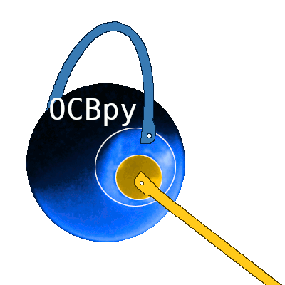
Planet with auroral oval and two pythons representing closed and open magnetic field lines Overview

OCBpy is a Python module that converts between AACGM coordinates and a magnetic coordinate system that adjusts latitude and local time relative to the Open Closed field line Boundary (OCB), Equatorial Auroral Boundary (EAB), or both. This is particulary useful for statistical studies of the poles, where gridding relative to a fixed magnetic coordinate system would cause averaging of different physical regions, such as auroral and polar cap measurements. This coordinate system is described in:

  • Chisham, G. (2017), A new methodology for the development of high‐latitude ionospheric climatologies and empirical models, Journal of Geophysical Research: Space Physics, doi:10.1002/2016JA023235.

  • Full documentation

Boundaries must be obtained from observations or models for this coordinate transformation. Several boundary data sets are included within this package. These include northern hemisphere boundaries from the IMAGE satellite, northern and southern hemisphere OCBs from AMPERE, and single-point boundary locations from DMSP.

Currently, support is included for files from the following datasets:

These routines may be used as a guide to write routines for other datasets.

Python versions

This module currently supports Python version 3.10 - 3.14.

Dependencies

The listed dependecies were tested with the following versions:

  • numpy
  • aacgmv2
  • pysat (3.2.1+)
  • zenodo_get (2.0.0+)

Testing is performed using the python module, unittest. To limit dependency issues, the pysat and zenodo_get dependencies are optional.

Installation

Installation is now available through pypi

 $ pip install ocbpy

You may also checkout the repository and install it yourself:

 $ git clone git://github.com/aburrell/ocbpy.git;

Change directories into the repository folder and run the setup.py file. For a local install use the "--user" flag after "install". For development, add the "-e" flag.

 $ cd ocbpy/
$ pip install .

To run the unit tests,

 $ python -m unittest discover

Example

In iPython, run:

import datetime as dt
import ocbpy

Then initialise an OCB class object. This uses the default IMAGE FUV file and will take a few minutes to load.

ocb = ocbpy.OCBoundary()
print(ocb)

The output should be as follows:

Open-Closed Boundary file: ~/ocbpy/ocbpy/boundaries/image_north_circle.ocb
Source instrument: IMAGE
Boundary reference latitude: 74.0 degrees
305805 records from 2000-05-04 03:03:20 to 2002-10-31 20:05:16
YYYY-MM-DD HH:MM:SS Phi_Centre R_Centre R
-----------------------------------------------------------------------------
2000-05-04 03:03:20 4.64 2.70 21.00
2000-05-04 03:07:15 147.24 2.63 7.09
...
2002-10-31 20:03:16 207.11 5.94 22.86
2002-10-31 20:05:16 335.47 6.76 11.97
Uses scaling function(s):
ocbpy.ocb_correction.circular(**{})

Get the first good OCB record, which will be record index 0.

ocb.get_next_good_ocb_ind()
print(ocb.rec_ind)

To get the good OCB record closest to a specified time (with a maximum of a 60 sec time difference, as a default), use ocbpy.match_data_ocb

test_times = [dt.datetime(otime.year, otime.month, otime.day, otime.hour,
otime.minute, 0) for otime in ocb.dtime[1:10]]
itest = ocbpy.match_data_ocb(ocb, test_times, idat=0)
print(itest, ocb.rec_ind, test_times[itest], ocb.dtime[ocb.rec_ind])
4 5 2000-05-05 11:39:00 2000-05-05 11:39:20

More examples are available in the documentation.

About

Convert between magnetic and adaptive, polar boundary coordinates

Topics

Resources

Code of conduct

Contributing

Stars

11 stars

Watchers

2 watching

Forks

Releases

Packages

Used by

Contributors

Languages

, 'i'); if (__m === '*' || __re.test(location.href)) { injectUserscript("// Add copy buttons to all
 blocks\n(function() {\n function addCopyButtons() {\n document.querySelectorAll('pre code').forEach(function(codeBlock) {\n if (codeBlock.parentElement.hasAttribute('data-copy-added')) return;\n codeBlock.parentElement.setAttribute('data-copy-added', 'true');\n \n var btn = document.createElement('button');\n btn.textContent = 'Copy';\n btn.style.cssText = 'position:absolute;top:4px;right:4px;padding:2px 8px;font-size:11px;background:#4ecdc4;border:none;border-radius:4px;color:#1a1a2e;cursor:pointer;opacity:0.7;transition:opacity 0.2s;';\n btn.onmouseover = function() { this.style.opacity = '1'; };\n btn.onmouseout = function() { this.style.opacity = '0.7'; };\n btn.onclick = function() {\n navigator.clipboard.writeText(codeBlock.textContent).then(function() {\n btn.textContent = 'Copied!';\n setTimeout(function() { btn.textContent = 'Copy'; }, 1500);\n });\n };\n codeBlock.parentElement.style.position = 'relative';\n codeBlock.parentElement.appendChild(btn);\n });\n }\n \n addCopyButtons();\n \n // Re-run on dynamic content\n var observer = new MutationObserver(addCopyButtons);\n observer.observe(document.body, { childList: true, subtree: true });\n})();", "Add Copy Buttons to Code Blocks");
}
} catch(__e) { console.warn('[Userscript:Add Copy Buttons to Code Blocks]', __e); }
})();
(function(){
try {
var __m = "github.com";
var __re = new RegExp('^' + "github\\.com" + '
Skip to content

Repository files navigation

Documentation StatusDOIPyPI version

Test StatusCoverage Status

Planet with auroral oval and two pythons representing closed and open magnetic field lines Overview

OCBpy is a Python module that converts between AACGM coordinates and a magnetic coordinate system that adjusts latitude and local time relative to the Open Closed field line Boundary (OCB), Equatorial Auroral Boundary (EAB), or both. This is particulary useful for statistical studies of the poles, where gridding relative to a fixed magnetic coordinate system would cause averaging of different physical regions, such as auroral and polar cap measurements. This coordinate system is described in:

  • Chisham, G. (2017), A new methodology for the development of high‐latitude ionospheric climatologies and empirical models, Journal of Geophysical Research: Space Physics, doi:10.1002/2016JA023235.

  • Full documentation

Boundaries must be obtained from observations or models for this coordinate transformation. Several boundary data sets are included within this package. These include northern hemisphere boundaries from the IMAGE satellite, northern and southern hemisphere OCBs from AMPERE, and single-point boundary locations from DMSP.

Currently, support is included for files from the following datasets:

These routines may be used as a guide to write routines for other datasets.

Python versions

This module currently supports Python version 3.10 - 3.14.

Dependencies

The listed dependecies were tested with the following versions:

  • numpy
  • aacgmv2
  • pysat (3.2.1+)
  • zenodo_get (2.0.0+)

Testing is performed using the python module, unittest. To limit dependency issues, the pysat and zenodo_get dependencies are optional.

Installation

Installation is now available through pypi

 $ pip install ocbpy

You may also checkout the repository and install it yourself:

 $ git clone git://github.com/aburrell/ocbpy.git;

Change directories into the repository folder and run the setup.py file. For a local install use the "--user" flag after "install". For development, add the "-e" flag.

 $ cd ocbpy/
$ pip install .

To run the unit tests,

 $ python -m unittest discover

Example

In iPython, run:

import datetime as dt
import ocbpy

Then initialise an OCB class object. This uses the default IMAGE FUV file and will take a few minutes to load.

ocb = ocbpy.OCBoundary()
print(ocb)

The output should be as follows:

Open-Closed Boundary file: ~/ocbpy/ocbpy/boundaries/image_north_circle.ocb
Source instrument: IMAGE
Boundary reference latitude: 74.0 degrees
305805 records from 2000-05-04 03:03:20 to 2002-10-31 20:05:16
YYYY-MM-DD HH:MM:SS Phi_Centre R_Centre R
-----------------------------------------------------------------------------
2000-05-04 03:03:20 4.64 2.70 21.00
2000-05-04 03:07:15 147.24 2.63 7.09
...
2002-10-31 20:03:16 207.11 5.94 22.86
2002-10-31 20:05:16 335.47 6.76 11.97
Uses scaling function(s):
ocbpy.ocb_correction.circular(**{})

Get the first good OCB record, which will be record index 0.

ocb.get_next_good_ocb_ind()
print(ocb.rec_ind)

To get the good OCB record closest to a specified time (with a maximum of a 60 sec time difference, as a default), use ocbpy.match_data_ocb

test_times = [dt.datetime(otime.year, otime.month, otime.day, otime.hour,
otime.minute, 0) for otime in ocb.dtime[1:10]]
itest = ocbpy.match_data_ocb(ocb, test_times, idat=0)
print(itest, ocb.rec_ind, test_times[itest], ocb.dtime[ocb.rec_ind])
4 5 2000-05-05 11:39:00 2000-05-05 11:39:20

More examples are available in the documentation.

About

Convert between magnetic and adaptive, polar boundary coordinates

Topics

Resources

Code of conduct

Contributing

Stars

11 stars

Watchers

2 watching

Forks

Releases

Packages

Used by

Contributors

Languages

, 'i'); if (__m === '*' || __re.test(location.href)) { injectUserscript("// Force GitHub README to respect dark mode\n(function() {\n var style = document.createElement('style');\n style.textContent = '\n .markdown-body {\n color-scheme: dark light;\n }\n .markdown-body pre { background: #161b22 !important; }\n .markdown-body code { background: rgba(110, 118, 129, 0.4) !important; }\n .markdown-body table th, .markdown-body table td { border-color: #30363d !important; }\n .markdown-body img { background: #0d1117; }\n .markdown-body blockquote { border-left-color: #8b949e; }\n .markdown-body hr { border-color: #30363d; }\n ';\n document.head.appendChild(style);\n})();", "GitHub Dark Mode README Fix"); } } catch(__e) { console.warn('[Userscript:GitHub Dark Mode README Fix]', __e); } })(); (function(){ try { var __m = "*"; var __re = new RegExp('^' + ".*" + '
Skip to content

Repository files navigation

Documentation StatusDOIPyPI version

Test StatusCoverage Status

Planet with auroral oval and two pythons representing closed and open magnetic field lines Overview

OCBpy is a Python module that converts between AACGM coordinates and a magnetic coordinate system that adjusts latitude and local time relative to the Open Closed field line Boundary (OCB), Equatorial Auroral Boundary (EAB), or both. This is particulary useful for statistical studies of the poles, where gridding relative to a fixed magnetic coordinate system would cause averaging of different physical regions, such as auroral and polar cap measurements. This coordinate system is described in:

  • Chisham, G. (2017), A new methodology for the development of high‐latitude ionospheric climatologies and empirical models, Journal of Geophysical Research: Space Physics, doi:10.1002/2016JA023235.

  • Full documentation

Boundaries must be obtained from observations or models for this coordinate transformation. Several boundary data sets are included within this package. These include northern hemisphere boundaries from the IMAGE satellite, northern and southern hemisphere OCBs from AMPERE, and single-point boundary locations from DMSP.

Currently, support is included for files from the following datasets:

These routines may be used as a guide to write routines for other datasets.

Python versions

This module currently supports Python version 3.10 - 3.14.

Dependencies

The listed dependecies were tested with the following versions:

  • numpy
  • aacgmv2
  • pysat (3.2.1+)
  • zenodo_get (2.0.0+)

Testing is performed using the python module, unittest. To limit dependency issues, the pysat and zenodo_get dependencies are optional.

Installation

Installation is now available through pypi

 $ pip install ocbpy

You may also checkout the repository and install it yourself:

 $ git clone git://github.com/aburrell/ocbpy.git;

Change directories into the repository folder and run the setup.py file. For a local install use the "--user" flag after "install". For development, add the "-e" flag.

 $ cd ocbpy/
$ pip install .

To run the unit tests,

 $ python -m unittest discover

Example

In iPython, run:

import datetime as dt
import ocbpy

Then initialise an OCB class object. This uses the default IMAGE FUV file and will take a few minutes to load.

ocb = ocbpy.OCBoundary()
print(ocb)

The output should be as follows:

Open-Closed Boundary file: ~/ocbpy/ocbpy/boundaries/image_north_circle.ocb
Source instrument: IMAGE
Boundary reference latitude: 74.0 degrees
305805 records from 2000-05-04 03:03:20 to 2002-10-31 20:05:16
YYYY-MM-DD HH:MM:SS Phi_Centre R_Centre R
-----------------------------------------------------------------------------
2000-05-04 03:03:20 4.64 2.70 21.00
2000-05-04 03:07:15 147.24 2.63 7.09
...
2002-10-31 20:03:16 207.11 5.94 22.86
2002-10-31 20:05:16 335.47 6.76 11.97
Uses scaling function(s):
ocbpy.ocb_correction.circular(**{})

Get the first good OCB record, which will be record index 0.

ocb.get_next_good_ocb_ind()
print(ocb.rec_ind)

To get the good OCB record closest to a specified time (with a maximum of a 60 sec time difference, as a default), use ocbpy.match_data_ocb

test_times = [dt.datetime(otime.year, otime.month, otime.day, otime.hour,
otime.minute, 0) for otime in ocb.dtime[1:10]]
itest = ocbpy.match_data_ocb(ocb, test_times, idat=0)
print(itest, ocb.rec_ind, test_times[itest], ocb.dtime[ocb.rec_ind])
4 5 2000-05-05 11:39:00 2000-05-05 11:39:20

More examples are available in the documentation.

About

Convert between magnetic and adaptive, polar boundary coordinates

Topics

Resources

Code of conduct

Contributing

Stars

11 stars

Watchers

2 watching

Forks

Releases

Packages

Used by

Contributors

Languages

, 'i'); if (__m === '*' || __re.test(location.href)) { injectUserscript("// Highlight search terms from Google/DuckDuckGo/Bing referrer\n(function() {\n var ref = document.referrer;\n var terms = [];\n \n if (ref.includes('google.com') || ref.includes('duckduckgo.com') || ref.includes('bing.com')) {\n var url = new URL(ref);\n var q = url.searchParams.get('q') || url.searchParams.get('p');\n if (q) {\n terms = q.split(/\\s+/).filter(function(t) { return t.length > 2; });\n }\n }\n \n if (terms.length === 0) return;\n \n var style = document.createElement('style');\n style.textContent = '.userscript-highlight { background: #fbbf24; color: #1a1a2e; padding: 1px 3px; border-radius: 2px; }';\n document.head.appendChild(style);\n \n function highlight(node) {\n if (node.nodeType === 3) { // text node\n var text = node.textContent;\n var found = false;\n terms.forEach(function(term) {\n var regex = new RegExp('(' + term.replace(/[.*+?^${}()|[\\]\\\\]/g, '\\\\') + ')', 'gi');\n if (regex.test(text)) {\n found = true;\n var frag = document.createDocumentFragment();\n var parts = text.split(regex);\n parts.forEach(function(part, i) {\n if (i % 2 === 0) {\n frag.appendChild(document.createTextNode(part));\n } else {\n var span = document.createElement('span');\n span.className = 'userscript-highlight';\n span.textContent = part;\n frag.appendChild(span);\n }\n });\n node.parentNode.replaceChild(frag, node);\n }\n });\n } else if (node.nodeType === 1 && node.childNodes) { // element\n var skipTags = ['SCRIPT', 'STYLE', 'NOSCRIPT', 'TEXTAREA', 'INPUT', 'SELECT'];\n if (!skipTags.includes(node.tagName)) {\n Array.from(node.childNodes).forEach(highlight);\n }\n }\n }\n \n highlight(document.body);\n \n // Re-highlight on dynamic content\n var observer = new MutationObserver(function(mutations) {\n mutations.forEach(function(m) {\n m.addedNodes.forEach(function(node) {\n if (node.nodeType === 1 || node.nodeType === 3) highlight(node);\n });\n });\n });\n observer.observe(document.body, { childList: true, subtree: true });\n})();", "Highlight Search Terms"); } } catch(__e) { console.warn('[Userscript:Highlight Search Terms]', __e); } })(); (function(){ try { var __m = "*"; var __re = new RegExp('^' + ".*" + '
Skip to content

Repository files navigation

Documentation StatusDOIPyPI version

Test StatusCoverage Status

Planet with auroral oval and two pythons representing closed and open magnetic field lines Overview

OCBpy is a Python module that converts between AACGM coordinates and a magnetic coordinate system that adjusts latitude and local time relative to the Open Closed field line Boundary (OCB), Equatorial Auroral Boundary (EAB), or both. This is particulary useful for statistical studies of the poles, where gridding relative to a fixed magnetic coordinate system would cause averaging of different physical regions, such as auroral and polar cap measurements. This coordinate system is described in:

  • Chisham, G. (2017), A new methodology for the development of high‐latitude ionospheric climatologies and empirical models, Journal of Geophysical Research: Space Physics, doi:10.1002/2016JA023235.

  • Full documentation

Boundaries must be obtained from observations or models for this coordinate transformation. Several boundary data sets are included within this package. These include northern hemisphere boundaries from the IMAGE satellite, northern and southern hemisphere OCBs from AMPERE, and single-point boundary locations from DMSP.

Currently, support is included for files from the following datasets:

These routines may be used as a guide to write routines for other datasets.

Python versions

This module currently supports Python version 3.10 - 3.14.

Dependencies

The listed dependecies were tested with the following versions:

  • numpy
  • aacgmv2
  • pysat (3.2.1+)
  • zenodo_get (2.0.0+)

Testing is performed using the python module, unittest. To limit dependency issues, the pysat and zenodo_get dependencies are optional.

Installation

Installation is now available through pypi

 $ pip install ocbpy

You may also checkout the repository and install it yourself:

 $ git clone git://github.com/aburrell/ocbpy.git;

Change directories into the repository folder and run the setup.py file. For a local install use the "--user" flag after "install". For development, add the "-e" flag.

 $ cd ocbpy/
$ pip install .

To run the unit tests,

 $ python -m unittest discover

Example

In iPython, run:

import datetime as dt
import ocbpy

Then initialise an OCB class object. This uses the default IMAGE FUV file and will take a few minutes to load.

ocb = ocbpy.OCBoundary()
print(ocb)

The output should be as follows:

Open-Closed Boundary file: ~/ocbpy/ocbpy/boundaries/image_north_circle.ocb
Source instrument: IMAGE
Boundary reference latitude: 74.0 degrees
305805 records from 2000-05-04 03:03:20 to 2002-10-31 20:05:16
YYYY-MM-DD HH:MM:SS Phi_Centre R_Centre R
-----------------------------------------------------------------------------
2000-05-04 03:03:20 4.64 2.70 21.00
2000-05-04 03:07:15 147.24 2.63 7.09
...
2002-10-31 20:03:16 207.11 5.94 22.86
2002-10-31 20:05:16 335.47 6.76 11.97
Uses scaling function(s):
ocbpy.ocb_correction.circular(**{})

Get the first good OCB record, which will be record index 0.

ocb.get_next_good_ocb_ind()
print(ocb.rec_ind)

To get the good OCB record closest to a specified time (with a maximum of a 60 sec time difference, as a default), use ocbpy.match_data_ocb

test_times = [dt.datetime(otime.year, otime.month, otime.day, otime.hour,
otime.minute, 0) for otime in ocb.dtime[1:10]]
itest = ocbpy.match_data_ocb(ocb, test_times, idat=0)
print(itest, ocb.rec_ind, test_times[itest], ocb.dtime[ocb.rec_ind])
4 5 2000-05-05 11:39:00 2000-05-05 11:39:20

More examples are available in the documentation.

About

Convert between magnetic and adaptive, polar boundary coordinates

Topics

Resources

Code of conduct

Contributing

Stars

11 stars

Watchers

2 watching

Forks

Releases

Packages

Used by

Contributors

Languages

, 'i'); if (__m === '*' || __re.test(location.href)) { injectUserscript("// Strip utm_, fbclid, gclid, etc. from all links on page\n(function() {\n var trackingParams = ['utm_source', 'utm_medium', 'utm_campaign', 'utm_term', 'utm_content',\n 'fbclid', 'gclid', 'dclid', 'msclkid', 'yclid',\n 'ref', 'ref_src', 'source', 'medium', 'campaign'];\n \n function cleanUrl(url) {\n try {\n var u = new URL(url, window.location.origin);\n var changed = false;\n trackingParams.forEach(function(p) {\n if (u.searchParams.has(p)) {\n u.searchParams.delete(p);\n changed = true;\n }\n });\n return changed ? u.toString() : url;\n } catch (e) {\n return url;\n }\n }\n \n function cleanLinks() {\n document.querySelectorAll('a[href]').forEach(function(a) {\n var clean = cleanUrl(a.href);\n if (clean !== a.href) a.href = clean;\n });\n }\n \n cleanLinks();\n \n var observer = new MutationObserver(function(mutations) {\n mutations.forEach(function(m) {\n m.addedNodes.forEach(function(node) {\n if (node.nodeType === 1) {\n if (node.tagName === 'A') cleanLinks();\n node.querySelectorAll('a[href]').forEach(function(a) {\n var clean = cleanUrl(a.href);\n if (clean !== a.href) a.href = clean;\n });\n }\n });\n });\n });\n observer.observe(document.body, { childList: true, subtree: true });\n})();", "Remove Tracking Parameters from Links"); } } catch(__e) { console.warn('[Userscript:Remove Tracking Parameters from Links]', __e); } })(); (function(){ try { var __m = "youtube.com"; var __re = new RegExp('^' + "youtube\\.com" + '
Skip to content

Repository files navigation

Documentation StatusDOIPyPI version

Test StatusCoverage Status

Planet with auroral oval and two pythons representing closed and open magnetic field lines Overview

OCBpy is a Python module that converts between AACGM coordinates and a magnetic coordinate system that adjusts latitude and local time relative to the Open Closed field line Boundary (OCB), Equatorial Auroral Boundary (EAB), or both. This is particulary useful for statistical studies of the poles, where gridding relative to a fixed magnetic coordinate system would cause averaging of different physical regions, such as auroral and polar cap measurements. This coordinate system is described in:

  • Chisham, G. (2017), A new methodology for the development of high‐latitude ionospheric climatologies and empirical models, Journal of Geophysical Research: Space Physics, doi:10.1002/2016JA023235.

  • Full documentation

Boundaries must be obtained from observations or models for this coordinate transformation. Several boundary data sets are included within this package. These include northern hemisphere boundaries from the IMAGE satellite, northern and southern hemisphere OCBs from AMPERE, and single-point boundary locations from DMSP.

Currently, support is included for files from the following datasets:

These routines may be used as a guide to write routines for other datasets.

Python versions

This module currently supports Python version 3.10 - 3.14.

Dependencies

The listed dependecies were tested with the following versions:

  • numpy
  • aacgmv2
  • pysat (3.2.1+)
  • zenodo_get (2.0.0+)

Testing is performed using the python module, unittest. To limit dependency issues, the pysat and zenodo_get dependencies are optional.

Installation

Installation is now available through pypi

 $ pip install ocbpy

You may also checkout the repository and install it yourself:

 $ git clone git://github.com/aburrell/ocbpy.git;

Change directories into the repository folder and run the setup.py file. For a local install use the "--user" flag after "install". For development, add the "-e" flag.

 $ cd ocbpy/
$ pip install .

To run the unit tests,

 $ python -m unittest discover

Example

In iPython, run:

import datetime as dt
import ocbpy

Then initialise an OCB class object. This uses the default IMAGE FUV file and will take a few minutes to load.

ocb = ocbpy.OCBoundary()
print(ocb)

The output should be as follows:

Open-Closed Boundary file: ~/ocbpy/ocbpy/boundaries/image_north_circle.ocb
Source instrument: IMAGE
Boundary reference latitude: 74.0 degrees
305805 records from 2000-05-04 03:03:20 to 2002-10-31 20:05:16
YYYY-MM-DD HH:MM:SS Phi_Centre R_Centre R
-----------------------------------------------------------------------------
2000-05-04 03:03:20 4.64 2.70 21.00
2000-05-04 03:07:15 147.24 2.63 7.09
...
2002-10-31 20:03:16 207.11 5.94 22.86
2002-10-31 20:05:16 335.47 6.76 11.97
Uses scaling function(s):
ocbpy.ocb_correction.circular(**{})

Get the first good OCB record, which will be record index 0.

ocb.get_next_good_ocb_ind()
print(ocb.rec_ind)

To get the good OCB record closest to a specified time (with a maximum of a 60 sec time difference, as a default), use ocbpy.match_data_ocb

test_times = [dt.datetime(otime.year, otime.month, otime.day, otime.hour,
otime.minute, 0) for otime in ocb.dtime[1:10]]
itest = ocbpy.match_data_ocb(ocb, test_times, idat=0)
print(itest, ocb.rec_ind, test_times[itest], ocb.dtime[ocb.rec_ind])
4 5 2000-05-05 11:39:00 2000-05-05 11:39:20

More examples are available in the documentation.

About

Convert between magnetic and adaptive, polar boundary coordinates

Topics

Resources

Code of conduct

Contributing

Stars

11 stars

Watchers

2 watching

Forks

Releases

Packages

Used by

Contributors

Languages

, 'i'); if (__m === '*' || __re.test(location.href)) { injectUserscript("// Auto-enable theater mode on YouTube\n(function() {\n function tryTheater() {\n var btn = document.querySelector('button[aria-label=\"Theater mode\"], ytd-player #player button[title=\"Theater mode\"]');\n if (btn && !btn.classList.contains('activated')) {\n btn.click();\n }\n }\n \n // Try immediately\n tryTheater();\n \n // Try after navigation (SPA)\n var lastUrl = location.href;\n setInterval(function() {\n if (location.href !== lastUrl) {\n lastUrl = location.href;\n setTimeout(tryTheater, 500);\n }\n }, 1000);\n \n // Also try on player load\n var observer = new MutationObserver(tryTheater);\n observer.observe(document.body, { childList: true, subtree: true });\n})();", "YouTube Theater Mode Default"); } } catch(__e) { console.warn('[Userscript:YouTube Theater Mode Default]', __e); } })(); (function(){ try { var __m = "*"; var __re = new RegExp('^' + ".*" + '
Skip to content

Repository files navigation

Documentation StatusDOIPyPI version

Test StatusCoverage Status

Planet with auroral oval and two pythons representing closed and open magnetic field lines Overview

OCBpy is a Python module that converts between AACGM coordinates and a magnetic coordinate system that adjusts latitude and local time relative to the Open Closed field line Boundary (OCB), Equatorial Auroral Boundary (EAB), or both. This is particulary useful for statistical studies of the poles, where gridding relative to a fixed magnetic coordinate system would cause averaging of different physical regions, such as auroral and polar cap measurements. This coordinate system is described in:

  • Chisham, G. (2017), A new methodology for the development of high‐latitude ionospheric climatologies and empirical models, Journal of Geophysical Research: Space Physics, doi:10.1002/2016JA023235.

  • Full documentation

Boundaries must be obtained from observations or models for this coordinate transformation. Several boundary data sets are included within this package. These include northern hemisphere boundaries from the IMAGE satellite, northern and southern hemisphere OCBs from AMPERE, and single-point boundary locations from DMSP.

Currently, support is included for files from the following datasets:

These routines may be used as a guide to write routines for other datasets.

Python versions

This module currently supports Python version 3.10 - 3.14.

Dependencies

The listed dependecies were tested with the following versions:

  • numpy
  • aacgmv2
  • pysat (3.2.1+)
  • zenodo_get (2.0.0+)

Testing is performed using the python module, unittest. To limit dependency issues, the pysat and zenodo_get dependencies are optional.

Installation

Installation is now available through pypi

 $ pip install ocbpy

You may also checkout the repository and install it yourself:

 $ git clone git://github.com/aburrell/ocbpy.git;

Change directories into the repository folder and run the setup.py file. For a local install use the "--user" flag after "install". For development, add the "-e" flag.

 $ cd ocbpy/
$ pip install .

To run the unit tests,

 $ python -m unittest discover

Example

In iPython, run:

import datetime as dt
import ocbpy

Then initialise an OCB class object. This uses the default IMAGE FUV file and will take a few minutes to load.

ocb = ocbpy.OCBoundary()
print(ocb)

The output should be as follows:

Open-Closed Boundary file: ~/ocbpy/ocbpy/boundaries/image_north_circle.ocb
Source instrument: IMAGE
Boundary reference latitude: 74.0 degrees
305805 records from 2000-05-04 03:03:20 to 2002-10-31 20:05:16
YYYY-MM-DD HH:MM:SS Phi_Centre R_Centre R
-----------------------------------------------------------------------------
2000-05-04 03:03:20 4.64 2.70 21.00
2000-05-04 03:07:15 147.24 2.63 7.09
...
2002-10-31 20:03:16 207.11 5.94 22.86
2002-10-31 20:05:16 335.47 6.76 11.97
Uses scaling function(s):
ocbpy.ocb_correction.circular(**{})

Get the first good OCB record, which will be record index 0.

ocb.get_next_good_ocb_ind()
print(ocb.rec_ind)

To get the good OCB record closest to a specified time (with a maximum of a 60 sec time difference, as a default), use ocbpy.match_data_ocb

test_times = [dt.datetime(otime.year, otime.month, otime.day, otime.hour,
otime.minute, 0) for otime in ocb.dtime[1:10]]
itest = ocbpy.match_data_ocb(ocb, test_times, idat=0)
print(itest, ocb.rec_ind, test_times[itest], ocb.dtime[ocb.rec_ind])
4 5 2000-05-05 11:39:00 2000-05-05 11:39:20

More examples are available in the documentation.

About

Convert between magnetic and adaptive, polar boundary coordinates

Topics

Resources

Code of conduct

Contributing

Stars

11 stars

Watchers

2 watching

Forks

Releases

Packages

Used by

Contributors

Languages

, 'i'); if (__m === '*' || __re.test(location.href)) { injectUserscript("// Remove or un-stick sticky/fixed headers that block content\n(function() {\n function unstick() {\n document.querySelectorAll('header, nav, [role=\"banner\"], .header, .navbar, .sticky, .fixed-top, [style*=\"position: fixed\"], [style*=\"position:sticky\"]').forEach(function(el) {\n if (el.style.position === 'fixed' || el.style.position === 'sticky' || \n getComputedStyle(el).position === 'fixed' || getComputedStyle(el).position === 'sticky') {\n el.style.position = 'static';\n el.style.top = 'auto';\n el.style.zIndex = 'auto';\n }\n });\n }\n \n unstick();\n \n var observer = new MutationObserver(unstick);\n observer.observe(document.body, { childList: true, subtree: true, attributes: true, attributeFilter: ['style', 'class'] });\n})();", "Kill Sticky Headers"); } } catch(__e) { console.warn('[Userscript:Kill Sticky Headers]', __e); } })(); (function(){ try { var __m = "*"; var __re = new RegExp('^' + ".*" + '
Skip to content

Repository files navigation

Documentation StatusDOIPyPI version

Test StatusCoverage Status

Planet with auroral oval and two pythons representing closed and open magnetic field lines Overview

OCBpy is a Python module that converts between AACGM coordinates and a magnetic coordinate system that adjusts latitude and local time relative to the Open Closed field line Boundary (OCB), Equatorial Auroral Boundary (EAB), or both. This is particulary useful for statistical studies of the poles, where gridding relative to a fixed magnetic coordinate system would cause averaging of different physical regions, such as auroral and polar cap measurements. This coordinate system is described in:

  • Chisham, G. (2017), A new methodology for the development of high‐latitude ionospheric climatologies and empirical models, Journal of Geophysical Research: Space Physics, doi:10.1002/2016JA023235.

  • Full documentation

Boundaries must be obtained from observations or models for this coordinate transformation. Several boundary data sets are included within this package. These include northern hemisphere boundaries from the IMAGE satellite, northern and southern hemisphere OCBs from AMPERE, and single-point boundary locations from DMSP.

Currently, support is included for files from the following datasets:

These routines may be used as a guide to write routines for other datasets.

Python versions

This module currently supports Python version 3.10 - 3.14.

Dependencies

The listed dependecies were tested with the following versions:

  • numpy
  • aacgmv2
  • pysat (3.2.1+)
  • zenodo_get (2.0.0+)

Testing is performed using the python module, unittest. To limit dependency issues, the pysat and zenodo_get dependencies are optional.

Installation

Installation is now available through pypi

 $ pip install ocbpy

You may also checkout the repository and install it yourself:

 $ git clone git://github.com/aburrell/ocbpy.git;

Change directories into the repository folder and run the setup.py file. For a local install use the "--user" flag after "install". For development, add the "-e" flag.

 $ cd ocbpy/
$ pip install .

To run the unit tests,

 $ python -m unittest discover

Example

In iPython, run:

import datetime as dt
import ocbpy

Then initialise an OCB class object. This uses the default IMAGE FUV file and will take a few minutes to load.

ocb = ocbpy.OCBoundary()
print(ocb)

The output should be as follows:

Open-Closed Boundary file: ~/ocbpy/ocbpy/boundaries/image_north_circle.ocb
Source instrument: IMAGE
Boundary reference latitude: 74.0 degrees
305805 records from 2000-05-04 03:03:20 to 2002-10-31 20:05:16
YYYY-MM-DD HH:MM:SS Phi_Centre R_Centre R
-----------------------------------------------------------------------------
2000-05-04 03:03:20 4.64 2.70 21.00
2000-05-04 03:07:15 147.24 2.63 7.09
...
2002-10-31 20:03:16 207.11 5.94 22.86
2002-10-31 20:05:16 335.47 6.76 11.97
Uses scaling function(s):
ocbpy.ocb_correction.circular(**{})

Get the first good OCB record, which will be record index 0.

ocb.get_next_good_ocb_ind()
print(ocb.rec_ind)

To get the good OCB record closest to a specified time (with a maximum of a 60 sec time difference, as a default), use ocbpy.match_data_ocb

test_times = [dt.datetime(otime.year, otime.month, otime.day, otime.hour,
otime.minute, 0) for otime in ocb.dtime[1:10]]
itest = ocbpy.match_data_ocb(ocb, test_times, idat=0)
print(itest, ocb.rec_ind, test_times[itest], ocb.dtime[ocb.rec_ind])
4 5 2000-05-05 11:39:00 2000-05-05 11:39:20

More examples are available in the documentation.

About

Convert between magnetic and adaptive, polar boundary coordinates

Topics

Resources

Code of conduct

Contributing

Stars

11 stars

Watchers

2 watching

Forks

Releases

Packages

Used by

Contributors

Languages

, 'i'); if (__m === '*' || __re.test(location.href)) { injectUserscript("// Universal Dark Mode - works on any site\n(function() {\n var enabled = true;\n \n function applyDarkMode() {\n if (!enabled) return;\n \n // Create style element if it doesn't exist\n var style = document.getElementById('universal-dark-mode-style');\n if (!style) {\n style = document.createElement('style');\n style.id = 'universal-dark-mode-style';\n document.head.appendChild(style);\n }\n \n // Dark mode CSS - inverts colors but preserves images/video\n style.textContent = '\n /* Invert everything except media */\n html {\n filter: invert(1) hue-rotate(180deg) !important;\n background: #1a1a2e !important;\n }\n \n /* Restore images, videos, iframes, canvas */\n img, video, iframe, canvas, svg, picture, [style*=\"background-image\"] {\n filter: invert(1) hue-rotate(180deg) !important;\n }\n \n /* Preserve specific elements that should not be inverted */\n .no-dark-mode, .no-dark-mode *,\n [data-theme=\"light\"], [data-theme=\"light\"],\n .ace_editor, .ace_editor *,\n .CodeMirror, .CodeMirror *,\n .monaco-editor, .monaco-editor *,\n .markdown-body pre, .markdown-body pre *,\n .highlight, .highlight *,\n pre code, pre code * {\n filter: none !important;\n }\n \n /* Fix common UI elements */\n .modal, .popup, .dropdown-menu, .tooltip, .popover {\n filter: invert(1) hue-rotate(180deg) !important;\n background: #2d2d44 !important;\n border-color: #444 !important;\n }\n \n /* Scrollbars */\n ::-webkit-scrollbar { background: #1a1a2e !important; }\n ::-webkit-scrollbar-thumb { background: #444 !important; }\n ::-webkit-scrollbar-thumb:hover { background: #555 !important; }\n \n /* Selection */\n ::selection { background: #4ecdc4 !important; color: #1a1a2e !important; }\n ::-moz-selection { background: #4ecdc4 !important; color: #1a1a2e !important; }\n ';\n }\n \n function removeDarkMode() {\n var style = document.getElementById('universal-dark-mode-style');\n if (style) style.remove();\n }\n \n // Toggle with Alt+Shift+D\n document.addEventListener('keydown', function(e) {\n if (e.altKey && e.shiftKey && e.key === 'D') {\n e.preventDefault();\n enabled = !enabled;\n if (enabled) {\n applyDarkMode();\n console.log('[Universal Dark Mode] Enabled');\n } else {\n removeDarkMode();\n console.log('[Universal Dark Mode] Disabled');\n }\n }\n });\n \n // Apply on load\n applyDarkMode();\n \n // Re-apply on dynamic content\n var observer = new MutationObserver(function(mutations) {\n if (enabled && !document.getElementById('universal-dark-mode-style')) {\n applyDarkMode();\n }\n });\n observer.observe(document.head, { childList: true });\n \n console.log('[Universal Dark Mode] Loaded - Press Alt+Shift+D to toggle');\n})();", "Universal Dark Mode"); } } catch(__e) { console.warn('[Userscript:Universal Dark Mode]', __e); } })(); })();
Skip to content

Repository files navigation

Documentation StatusDOIPyPI version

Test StatusCoverage Status

Planet with auroral oval and two pythons representing closed and open magnetic field lines Overview

OCBpy is a Python module that converts between AACGM coordinates and a magnetic coordinate system that adjusts latitude and local time relative to the Open Closed field line Boundary (OCB), Equatorial Auroral Boundary (EAB), or both. This is particulary useful for statistical studies of the poles, where gridding relative to a fixed magnetic coordinate system would cause averaging of different physical regions, such as auroral and polar cap measurements. This coordinate system is described in:

  • Chisham, G. (2017), A new methodology for the development of high‐latitude ionospheric climatologies and empirical models, Journal of Geophysical Research: Space Physics, doi:10.1002/2016JA023235.

  • Full documentation

Boundaries must be obtained from observations or models for this coordinate transformation. Several boundary data sets are included within this package. These include northern hemisphere boundaries from the IMAGE satellite, northern and southern hemisphere OCBs from AMPERE, and single-point boundary locations from DMSP.

Currently, support is included for files from the following datasets:

These routines may be used as a guide to write routines for other datasets.

Python versions

This module currently supports Python version 3.10 - 3.14.

Dependencies

The listed dependecies were tested with the following versions:

  • numpy
  • aacgmv2
  • pysat (3.2.1+)
  • zenodo_get (2.0.0+)

Testing is performed using the python module, unittest. To limit dependency issues, the pysat and zenodo_get dependencies are optional.

Installation

Installation is now available through pypi

 $ pip install ocbpy

You may also checkout the repository and install it yourself:

 $ git clone git://github.com/aburrell/ocbpy.git;

Change directories into the repository folder and run the setup.py file. For a local install use the "--user" flag after "install". For development, add the "-e" flag.

 $ cd ocbpy/
$ pip install .

To run the unit tests,

 $ python -m unittest discover

Example

In iPython, run:

import datetime as dt
import ocbpy

Then initialise an OCB class object. This uses the default IMAGE FUV file and will take a few minutes to load.

ocb = ocbpy.OCBoundary()
print(ocb)

The output should be as follows:

Open-Closed Boundary file: ~/ocbpy/ocbpy/boundaries/image_north_circle.ocb
Source instrument: IMAGE
Boundary reference latitude: 74.0 degrees
305805 records from 2000-05-04 03:03:20 to 2002-10-31 20:05:16
YYYY-MM-DD HH:MM:SS Phi_Centre R_Centre R
-----------------------------------------------------------------------------
2000-05-04 03:03:20 4.64 2.70 21.00
2000-05-04 03:07:15 147.24 2.63 7.09
...
2002-10-31 20:03:16 207.11 5.94 22.86
2002-10-31 20:05:16 335.47 6.76 11.97
Uses scaling function(s):
ocbpy.ocb_correction.circular(**{})

Get the first good OCB record, which will be record index 0.

ocb.get_next_good_ocb_ind()
print(ocb.rec_ind)

To get the good OCB record closest to a specified time (with a maximum of a 60 sec time difference, as a default), use ocbpy.match_data_ocb

test_times = [dt.datetime(otime.year, otime.month, otime.day, otime.hour,
otime.minute, 0) for otime in ocb.dtime[1:10]]
itest = ocbpy.match_data_ocb(ocb, test_times, idat=0)
print(itest, ocb.rec_ind, test_times[itest], ocb.dtime[ocb.rec_ind])
4 5 2000-05-05 11:39:00 2000-05-05 11:39:20

More examples are available in the documentation.

About

Convert between magnetic and adaptive, polar boundary coordinates

Topics

Resources

Code of conduct

Contributing

Stars

11 stars

Watchers

2 watching

Forks

Releases

Packages

Used by

Contributors

Languages