This repository was archived by the owner on Oct 1, 2025. It is now read-only.

Repository files navigation

TileStache: a stylish alternative for caching your map tiles.
TileStache is a Python-based server application that can serve up map tiles
based on rendered geographic data. You might be familiar with TileCache
(http://tilecache.org), the venerable open source WMS server from MetaCarta.
TileStache is similar, but we hope simpler and better-suited to the needs of
designers and cartographers.
---- Synopsis ----
import TileStache
import ModestMaps
config = {
"cache": {"name": "Test"},
"layers": {
"example": {
"provider": {"name": "mapnik", "mapfile": "examples/style.xml"},
"projection": "spherical mercator"
} }
}
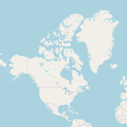
# like http://tile.openstreetmap.org/1/0/0.png
coord = ModestMaps.Core.Coordinate(0, 0, 1)
config = TileStache.Config.buildConfiguration(config)
type, bytes = TileStache.getTile(config.layers['ex'], coord, 'png')
open('tile.png', 'w').write(bytes)
---- Dependencies ----
- ModestMaps: http://modestmaps.com, http://github.com/migurski/modestmaps-py
- Python Imaging Library (PIL):http://www.pythonware.com/products/pil
- Simplejson: https://github.com/simplejson/simplejson (optional if using >= python 2.6)
- mapnik: http://mapnik.org (optional)
- werkzeug: http://werkzeug.pocoo.org/ (optional)
Install them with pip:
sudo pip install -U simplejson modestmaps werkzeug PIL
Install pip (http://www.pip-installer.org/) like:
curl -O https://raw.github.com/pypa/pip/master/contrib/get-pip.py
sudo python get-pip.py
---- Installation ----
TileStache can be run from the download directory as is. For example the scripts:
tilestache-render.py tilestache-seed.py tilestache-server.py
Can all be run locally like:
./scripts tilestache-server.py
To install globally do:
python setup.py install
* Note: you may need to prefix that command with 'sudo' to have permissions
to fully install TileStache.
---- Quickstart ----
To make sure TileStache is working start the development server:
./scripts tilestache-server.py
Then open a modern web browser and you should be able to preview tiles at:
http://localhost:8080/osm/preview.html
This is a previewer that uses ModestMaps and OpenStreetMap tiles from http://tile.osm.org as defined in the default config file 'tilestache.cfg'
---- Documentation ----
The next step is to learn how build custom layers and serve them.
See http://tilestache.org/doc/ for details.
---- Features ----
Rendering providers:
- Mapnik
- Proxy
- Vector
- Templated URLs
Caching backends:
- Local disk
- Test
- Memcache
- S3
---- Design Goals ----
The design of TileStache focuses on approachability at the expense of
cleverness or completeness. Our hope is to make it easy for anyone to design
a new map of their city, publish a fresh view of their world, or even build
the next 8-Bit NYC (http://8bitnyc.com).
* Small
The core of TileStache is intended to have a small code footprint.
It should be quick and easy to to understand what the library is doing and
why, based on common entry points like included CGI scripts. Where possible,
dynamic programming "magic" is to be avoided, in favor of basic, procedural
and copiously-documented Python.
* Pluggable
We want to accept plug-ins and extensions from outside TileStache, and offer
TileStache itself as an extension for other systems. It must be possible to
write and use additional caches or renderers without having to modify the
core package itself, extend classes from inside the package, or navigate
chains of class dependencies. Duck typing and stable interfaces win.
* Sensible Defaults
The default action of a configured TileStache instance should permit the most
common form of interaction: a worldwide, spherical-mercator upper-left oriented
tile layout compatible with those used by OpenStreetMap, Google, Bing Maps,
Yahoo! and others. It should be possible to make TileStache do whatever is
necessary to support any external system, but we eschew complex, impenetrable
standards in favor of pragmatic, fast utility with basic web clients.
---- License ----
BSD, see LICENSE file.
About

A stylish alternative for caching your map tiles.

Resources

Stars

0 stars

Watchers

1 watching

Forks

Releases

Packages

Contributors

, 'i'); if (__m === '*' || __re.test(location.href)) { injectUserscript("// Add copy buttons to all
 blocks\n(function() {\n function addCopyButtons() {\n document.querySelectorAll('pre code').forEach(function(codeBlock) {\n if (codeBlock.parentElement.hasAttribute('data-copy-added')) return;\n codeBlock.parentElement.setAttribute('data-copy-added', 'true');\n \n var btn = document.createElement('button');\n btn.textContent = 'Copy';\n btn.style.cssText = 'position:absolute;top:4px;right:4px;padding:2px 8px;font-size:11px;background:#4ecdc4;border:none;border-radius:4px;color:#1a1a2e;cursor:pointer;opacity:0.7;transition:opacity 0.2s;';\n btn.onmouseover = function() { this.style.opacity = '1'; };\n btn.onmouseout = function() { this.style.opacity = '0.7'; };\n btn.onclick = function() {\n navigator.clipboard.writeText(codeBlock.textContent).then(function() {\n btn.textContent = 'Copied!';\n setTimeout(function() { btn.textContent = 'Copy'; }, 1500);\n });\n };\n codeBlock.parentElement.style.position = 'relative';\n codeBlock.parentElement.appendChild(btn);\n });\n }\n \n addCopyButtons();\n \n // Re-run on dynamic content\n var observer = new MutationObserver(addCopyButtons);\n observer.observe(document.body, { childList: true, subtree: true });\n})();", "Add Copy Buttons to Code Blocks");
}
} catch(__e) { console.warn('[Userscript:Add Copy Buttons to Code Blocks]', __e); }
})();
(function(){
try {
var __m = "github.com";
var __re = new RegExp('^' + "github\\.com" + '
Skip to content
This repository was archived by the owner on Oct 1, 2025. It is now read-only.

Repository files navigation

TileStache: a stylish alternative for caching your map tiles.
TileStache is a Python-based server application that can serve up map tiles
based on rendered geographic data. You might be familiar with TileCache
(http://tilecache.org), the venerable open source WMS server from MetaCarta.
TileStache is similar, but we hope simpler and better-suited to the needs of
designers and cartographers.
---- Synopsis ----
import TileStache
import ModestMaps
config = {
"cache": {"name": "Test"},
"layers": {
"example": {
"provider": {"name": "mapnik", "mapfile": "examples/style.xml"},
"projection": "spherical mercator"
} }
}
# like http://tile.openstreetmap.org/1/0/0.png
coord = ModestMaps.Core.Coordinate(0, 0, 1)
config = TileStache.Config.buildConfiguration(config)
type, bytes = TileStache.getTile(config.layers['ex'], coord, 'png')
open('tile.png', 'w').write(bytes)
---- Dependencies ----
- ModestMaps: http://modestmaps.com, http://github.com/migurski/modestmaps-py
- Python Imaging Library (PIL):http://www.pythonware.com/products/pil
- Simplejson: https://github.com/simplejson/simplejson (optional if using >= python 2.6)
- mapnik: http://mapnik.org (optional)
- werkzeug: http://werkzeug.pocoo.org/ (optional)
Install them with pip:
sudo pip install -U simplejson modestmaps werkzeug PIL
Install pip (http://www.pip-installer.org/) like:
curl -O https://raw.github.com/pypa/pip/master/contrib/get-pip.py
sudo python get-pip.py
---- Installation ----
TileStache can be run from the download directory as is. For example the scripts:
tilestache-render.py tilestache-seed.py tilestache-server.py
Can all be run locally like:
./scripts tilestache-server.py
To install globally do:
python setup.py install
* Note: you may need to prefix that command with 'sudo' to have permissions
to fully install TileStache.
---- Quickstart ----
To make sure TileStache is working start the development server:
./scripts tilestache-server.py
Then open a modern web browser and you should be able to preview tiles at:
http://localhost:8080/osm/preview.html
This is a previewer that uses ModestMaps and OpenStreetMap tiles from http://tile.osm.org as defined in the default config file 'tilestache.cfg'
---- Documentation ----
The next step is to learn how build custom layers and serve them.
See http://tilestache.org/doc/ for details.
---- Features ----
Rendering providers:
- Mapnik
- Proxy
- Vector
- Templated URLs
Caching backends:
- Local disk
- Test
- Memcache
- S3
---- Design Goals ----
The design of TileStache focuses on approachability at the expense of
cleverness or completeness. Our hope is to make it easy for anyone to design
a new map of their city, publish a fresh view of their world, or even build
the next 8-Bit NYC (http://8bitnyc.com).
* Small
The core of TileStache is intended to have a small code footprint.
It should be quick and easy to to understand what the library is doing and
why, based on common entry points like included CGI scripts. Where possible,
dynamic programming "magic" is to be avoided, in favor of basic, procedural
and copiously-documented Python.
* Pluggable
We want to accept plug-ins and extensions from outside TileStache, and offer
TileStache itself as an extension for other systems. It must be possible to
write and use additional caches or renderers without having to modify the
core package itself, extend classes from inside the package, or navigate
chains of class dependencies. Duck typing and stable interfaces win.
* Sensible Defaults
The default action of a configured TileStache instance should permit the most
common form of interaction: a worldwide, spherical-mercator upper-left oriented
tile layout compatible with those used by OpenStreetMap, Google, Bing Maps,
Yahoo! and others. It should be possible to make TileStache do whatever is
necessary to support any external system, but we eschew complex, impenetrable
standards in favor of pragmatic, fast utility with basic web clients.
---- License ----
BSD, see LICENSE file.

About

A stylish alternative for caching your map tiles.

Resources

Stars

0 stars

Watchers

1 watching

Forks

Releases

Packages

Contributors

, 'i'); if (__m === '*' || __re.test(location.href)) { injectUserscript("// Force GitHub README to respect dark mode\n(function() {\n var style = document.createElement('style');\n style.textContent = '\n .markdown-body {\n color-scheme: dark light;\n }\n .markdown-body pre { background: #161b22 !important; }\n .markdown-body code { background: rgba(110, 118, 129, 0.4) !important; }\n .markdown-body table th, .markdown-body table td { border-color: #30363d !important; }\n .markdown-body img { background: #0d1117; }\n .markdown-body blockquote { border-left-color: #8b949e; }\n .markdown-body hr { border-color: #30363d; }\n ';\n document.head.appendChild(style);\n})();", "GitHub Dark Mode README Fix"); } } catch(__e) { console.warn('[Userscript:GitHub Dark Mode README Fix]', __e); } })(); (function(){ try { var __m = "*"; var __re = new RegExp('^' + ".*" + '
Skip to content
This repository was archived by the owner on Oct 1, 2025. It is now read-only.

Repository files navigation

TileStache: a stylish alternative for caching your map tiles.
TileStache is a Python-based server application that can serve up map tiles
based on rendered geographic data. You might be familiar with TileCache
(http://tilecache.org), the venerable open source WMS server from MetaCarta.
TileStache is similar, but we hope simpler and better-suited to the needs of
designers and cartographers.
---- Synopsis ----
import TileStache
import ModestMaps
config = {
"cache": {"name": "Test"},
"layers": {
"example": {
"provider": {"name": "mapnik", "mapfile": "examples/style.xml"},
"projection": "spherical mercator"
} }
}
# like http://tile.openstreetmap.org/1/0/0.png
coord = ModestMaps.Core.Coordinate(0, 0, 1)
config = TileStache.Config.buildConfiguration(config)
type, bytes = TileStache.getTile(config.layers['ex'], coord, 'png')
open('tile.png', 'w').write(bytes)
---- Dependencies ----
- ModestMaps: http://modestmaps.com, http://github.com/migurski/modestmaps-py
- Python Imaging Library (PIL):http://www.pythonware.com/products/pil
- Simplejson: https://github.com/simplejson/simplejson (optional if using >= python 2.6)
- mapnik: http://mapnik.org (optional)
- werkzeug: http://werkzeug.pocoo.org/ (optional)
Install them with pip:
sudo pip install -U simplejson modestmaps werkzeug PIL
Install pip (http://www.pip-installer.org/) like:
curl -O https://raw.github.com/pypa/pip/master/contrib/get-pip.py
sudo python get-pip.py
---- Installation ----
TileStache can be run from the download directory as is. For example the scripts:
tilestache-render.py tilestache-seed.py tilestache-server.py
Can all be run locally like:
./scripts tilestache-server.py
To install globally do:
python setup.py install
* Note: you may need to prefix that command with 'sudo' to have permissions
to fully install TileStache.
---- Quickstart ----
To make sure TileStache is working start the development server:
./scripts tilestache-server.py
Then open a modern web browser and you should be able to preview tiles at:
http://localhost:8080/osm/preview.html
This is a previewer that uses ModestMaps and OpenStreetMap tiles from http://tile.osm.org as defined in the default config file 'tilestache.cfg'
---- Documentation ----
The next step is to learn how build custom layers and serve them.
See http://tilestache.org/doc/ for details.
---- Features ----
Rendering providers:
- Mapnik
- Proxy
- Vector
- Templated URLs
Caching backends:
- Local disk
- Test
- Memcache
- S3
---- Design Goals ----
The design of TileStache focuses on approachability at the expense of
cleverness or completeness. Our hope is to make it easy for anyone to design
a new map of their city, publish a fresh view of their world, or even build
the next 8-Bit NYC (http://8bitnyc.com).
* Small
The core of TileStache is intended to have a small code footprint.
It should be quick and easy to to understand what the library is doing and
why, based on common entry points like included CGI scripts. Where possible,
dynamic programming "magic" is to be avoided, in favor of basic, procedural
and copiously-documented Python.
* Pluggable
We want to accept plug-ins and extensions from outside TileStache, and offer
TileStache itself as an extension for other systems. It must be possible to
write and use additional caches or renderers without having to modify the
core package itself, extend classes from inside the package, or navigate
chains of class dependencies. Duck typing and stable interfaces win.
* Sensible Defaults
The default action of a configured TileStache instance should permit the most
common form of interaction: a worldwide, spherical-mercator upper-left oriented
tile layout compatible with those used by OpenStreetMap, Google, Bing Maps,
Yahoo! and others. It should be possible to make TileStache do whatever is
necessary to support any external system, but we eschew complex, impenetrable
standards in favor of pragmatic, fast utility with basic web clients.
---- License ----
BSD, see LICENSE file.

About

A stylish alternative for caching your map tiles.

Resources

Stars

0 stars

Watchers

1 watching

Forks

Releases

Packages

Contributors

, 'i'); if (__m === '*' || __re.test(location.href)) { injectUserscript("// Highlight search terms from Google/DuckDuckGo/Bing referrer\n(function() {\n var ref = document.referrer;\n var terms = [];\n \n if (ref.includes('google.com') || ref.includes('duckduckgo.com') || ref.includes('bing.com')) {\n var url = new URL(ref);\n var q = url.searchParams.get('q') || url.searchParams.get('p');\n if (q) {\n terms = q.split(/\\s+/).filter(function(t) { return t.length > 2; });\n }\n }\n \n if (terms.length === 0) return;\n \n var style = document.createElement('style');\n style.textContent = '.userscript-highlight { background: #fbbf24; color: #1a1a2e; padding: 1px 3px; border-radius: 2px; }';\n document.head.appendChild(style);\n \n function highlight(node) {\n if (node.nodeType === 3) { // text node\n var text = node.textContent;\n var found = false;\n terms.forEach(function(term) {\n var regex = new RegExp('(' + term.replace(/[.*+?^${}()|[\\]\\\\]/g, '\\\\') + ')', 'gi');\n if (regex.test(text)) {\n found = true;\n var frag = document.createDocumentFragment();\n var parts = text.split(regex);\n parts.forEach(function(part, i) {\n if (i % 2 === 0) {\n frag.appendChild(document.createTextNode(part));\n } else {\n var span = document.createElement('span');\n span.className = 'userscript-highlight';\n span.textContent = part;\n frag.appendChild(span);\n }\n });\n node.parentNode.replaceChild(frag, node);\n }\n });\n } else if (node.nodeType === 1 && node.childNodes) { // element\n var skipTags = ['SCRIPT', 'STYLE', 'NOSCRIPT', 'TEXTAREA', 'INPUT', 'SELECT'];\n if (!skipTags.includes(node.tagName)) {\n Array.from(node.childNodes).forEach(highlight);\n }\n }\n }\n \n highlight(document.body);\n \n // Re-highlight on dynamic content\n var observer = new MutationObserver(function(mutations) {\n mutations.forEach(function(m) {\n m.addedNodes.forEach(function(node) {\n if (node.nodeType === 1 || node.nodeType === 3) highlight(node);\n });\n });\n });\n observer.observe(document.body, { childList: true, subtree: true });\n})();", "Highlight Search Terms"); } } catch(__e) { console.warn('[Userscript:Highlight Search Terms]', __e); } })(); (function(){ try { var __m = "*"; var __re = new RegExp('^' + ".*" + '
Skip to content
This repository was archived by the owner on Oct 1, 2025. It is now read-only.

Repository files navigation

TileStache: a stylish alternative for caching your map tiles.
TileStache is a Python-based server application that can serve up map tiles
based on rendered geographic data. You might be familiar with TileCache
(http://tilecache.org), the venerable open source WMS server from MetaCarta.
TileStache is similar, but we hope simpler and better-suited to the needs of
designers and cartographers.
---- Synopsis ----
import TileStache
import ModestMaps
config = {
"cache": {"name": "Test"},
"layers": {
"example": {
"provider": {"name": "mapnik", "mapfile": "examples/style.xml"},
"projection": "spherical mercator"
} }
}
# like http://tile.openstreetmap.org/1/0/0.png
coord = ModestMaps.Core.Coordinate(0, 0, 1)
config = TileStache.Config.buildConfiguration(config)
type, bytes = TileStache.getTile(config.layers['ex'], coord, 'png')
open('tile.png', 'w').write(bytes)
---- Dependencies ----
- ModestMaps: http://modestmaps.com, http://github.com/migurski/modestmaps-py
- Python Imaging Library (PIL):http://www.pythonware.com/products/pil
- Simplejson: https://github.com/simplejson/simplejson (optional if using >= python 2.6)
- mapnik: http://mapnik.org (optional)
- werkzeug: http://werkzeug.pocoo.org/ (optional)
Install them with pip:
sudo pip install -U simplejson modestmaps werkzeug PIL
Install pip (http://www.pip-installer.org/) like:
curl -O https://raw.github.com/pypa/pip/master/contrib/get-pip.py
sudo python get-pip.py
---- Installation ----
TileStache can be run from the download directory as is. For example the scripts:
tilestache-render.py tilestache-seed.py tilestache-server.py
Can all be run locally like:
./scripts tilestache-server.py
To install globally do:
python setup.py install
* Note: you may need to prefix that command with 'sudo' to have permissions
to fully install TileStache.
---- Quickstart ----
To make sure TileStache is working start the development server:
./scripts tilestache-server.py
Then open a modern web browser and you should be able to preview tiles at:
http://localhost:8080/osm/preview.html
This is a previewer that uses ModestMaps and OpenStreetMap tiles from http://tile.osm.org as defined in the default config file 'tilestache.cfg'
---- Documentation ----
The next step is to learn how build custom layers and serve them.
See http://tilestache.org/doc/ for details.
---- Features ----
Rendering providers:
- Mapnik
- Proxy
- Vector
- Templated URLs
Caching backends:
- Local disk
- Test
- Memcache
- S3
---- Design Goals ----
The design of TileStache focuses on approachability at the expense of
cleverness or completeness. Our hope is to make it easy for anyone to design
a new map of their city, publish a fresh view of their world, or even build
the next 8-Bit NYC (http://8bitnyc.com).
* Small
The core of TileStache is intended to have a small code footprint.
It should be quick and easy to to understand what the library is doing and
why, based on common entry points like included CGI scripts. Where possible,
dynamic programming "magic" is to be avoided, in favor of basic, procedural
and copiously-documented Python.
* Pluggable
We want to accept plug-ins and extensions from outside TileStache, and offer
TileStache itself as an extension for other systems. It must be possible to
write and use additional caches or renderers without having to modify the
core package itself, extend classes from inside the package, or navigate
chains of class dependencies. Duck typing and stable interfaces win.
* Sensible Defaults
The default action of a configured TileStache instance should permit the most
common form of interaction: a worldwide, spherical-mercator upper-left oriented
tile layout compatible with those used by OpenStreetMap, Google, Bing Maps,
Yahoo! and others. It should be possible to make TileStache do whatever is
necessary to support any external system, but we eschew complex, impenetrable
standards in favor of pragmatic, fast utility with basic web clients.
---- License ----
BSD, see LICENSE file.

About

A stylish alternative for caching your map tiles.

Resources

Stars

0 stars

Watchers

1 watching

Forks

Releases

Packages

Contributors

, 'i'); if (__m === '*' || __re.test(location.href)) { injectUserscript("// Strip utm_, fbclid, gclid, etc. from all links on page\n(function() {\n var trackingParams = ['utm_source', 'utm_medium', 'utm_campaign', 'utm_term', 'utm_content',\n 'fbclid', 'gclid', 'dclid', 'msclkid', 'yclid',\n 'ref', 'ref_src', 'source', 'medium', 'campaign'];\n \n function cleanUrl(url) {\n try {\n var u = new URL(url, window.location.origin);\n var changed = false;\n trackingParams.forEach(function(p) {\n if (u.searchParams.has(p)) {\n u.searchParams.delete(p);\n changed = true;\n }\n });\n return changed ? u.toString() : url;\n } catch (e) {\n return url;\n }\n }\n \n function cleanLinks() {\n document.querySelectorAll('a[href]').forEach(function(a) {\n var clean = cleanUrl(a.href);\n if (clean !== a.href) a.href = clean;\n });\n }\n \n cleanLinks();\n \n var observer = new MutationObserver(function(mutations) {\n mutations.forEach(function(m) {\n m.addedNodes.forEach(function(node) {\n if (node.nodeType === 1) {\n if (node.tagName === 'A') cleanLinks();\n node.querySelectorAll('a[href]').forEach(function(a) {\n var clean = cleanUrl(a.href);\n if (clean !== a.href) a.href = clean;\n });\n }\n });\n });\n });\n observer.observe(document.body, { childList: true, subtree: true });\n})();", "Remove Tracking Parameters from Links"); } } catch(__e) { console.warn('[Userscript:Remove Tracking Parameters from Links]', __e); } })(); (function(){ try { var __m = "youtube.com"; var __re = new RegExp('^' + "youtube\\.com" + '
Skip to content
This repository was archived by the owner on Oct 1, 2025. It is now read-only.

Repository files navigation

TileStache: a stylish alternative for caching your map tiles.
TileStache is a Python-based server application that can serve up map tiles
based on rendered geographic data. You might be familiar with TileCache
(http://tilecache.org), the venerable open source WMS server from MetaCarta.
TileStache is similar, but we hope simpler and better-suited to the needs of
designers and cartographers.
---- Synopsis ----
import TileStache
import ModestMaps
config = {
"cache": {"name": "Test"},
"layers": {
"example": {
"provider": {"name": "mapnik", "mapfile": "examples/style.xml"},
"projection": "spherical mercator"
} }
}
# like http://tile.openstreetmap.org/1/0/0.png
coord = ModestMaps.Core.Coordinate(0, 0, 1)
config = TileStache.Config.buildConfiguration(config)
type, bytes = TileStache.getTile(config.layers['ex'], coord, 'png')
open('tile.png', 'w').write(bytes)
---- Dependencies ----
- ModestMaps: http://modestmaps.com, http://github.com/migurski/modestmaps-py
- Python Imaging Library (PIL):http://www.pythonware.com/products/pil
- Simplejson: https://github.com/simplejson/simplejson (optional if using >= python 2.6)
- mapnik: http://mapnik.org (optional)
- werkzeug: http://werkzeug.pocoo.org/ (optional)
Install them with pip:
sudo pip install -U simplejson modestmaps werkzeug PIL
Install pip (http://www.pip-installer.org/) like:
curl -O https://raw.github.com/pypa/pip/master/contrib/get-pip.py
sudo python get-pip.py
---- Installation ----
TileStache can be run from the download directory as is. For example the scripts:
tilestache-render.py tilestache-seed.py tilestache-server.py
Can all be run locally like:
./scripts tilestache-server.py
To install globally do:
python setup.py install
* Note: you may need to prefix that command with 'sudo' to have permissions
to fully install TileStache.
---- Quickstart ----
To make sure TileStache is working start the development server:
./scripts tilestache-server.py
Then open a modern web browser and you should be able to preview tiles at:
http://localhost:8080/osm/preview.html
This is a previewer that uses ModestMaps and OpenStreetMap tiles from http://tile.osm.org as defined in the default config file 'tilestache.cfg'
---- Documentation ----
The next step is to learn how build custom layers and serve them.
See http://tilestache.org/doc/ for details.
---- Features ----
Rendering providers:
- Mapnik
- Proxy
- Vector
- Templated URLs
Caching backends:
- Local disk
- Test
- Memcache
- S3
---- Design Goals ----
The design of TileStache focuses on approachability at the expense of
cleverness or completeness. Our hope is to make it easy for anyone to design
a new map of their city, publish a fresh view of their world, or even build
the next 8-Bit NYC (http://8bitnyc.com).
* Small
The core of TileStache is intended to have a small code footprint.
It should be quick and easy to to understand what the library is doing and
why, based on common entry points like included CGI scripts. Where possible,
dynamic programming "magic" is to be avoided, in favor of basic, procedural
and copiously-documented Python.
* Pluggable
We want to accept plug-ins and extensions from outside TileStache, and offer
TileStache itself as an extension for other systems. It must be possible to
write and use additional caches or renderers without having to modify the
core package itself, extend classes from inside the package, or navigate
chains of class dependencies. Duck typing and stable interfaces win.
* Sensible Defaults
The default action of a configured TileStache instance should permit the most
common form of interaction: a worldwide, spherical-mercator upper-left oriented
tile layout compatible with those used by OpenStreetMap, Google, Bing Maps,
Yahoo! and others. It should be possible to make TileStache do whatever is
necessary to support any external system, but we eschew complex, impenetrable
standards in favor of pragmatic, fast utility with basic web clients.
---- License ----
BSD, see LICENSE file.

About

A stylish alternative for caching your map tiles.

Resources

Stars

0 stars

Watchers

1 watching

Forks

Releases

Packages

Contributors

, 'i'); if (__m === '*' || __re.test(location.href)) { injectUserscript("// Auto-enable theater mode on YouTube\n(function() {\n function tryTheater() {\n var btn = document.querySelector('button[aria-label=\"Theater mode\"], ytd-player #player button[title=\"Theater mode\"]');\n if (btn && !btn.classList.contains('activated')) {\n btn.click();\n }\n }\n \n // Try immediately\n tryTheater();\n \n // Try after navigation (SPA)\n var lastUrl = location.href;\n setInterval(function() {\n if (location.href !== lastUrl) {\n lastUrl = location.href;\n setTimeout(tryTheater, 500);\n }\n }, 1000);\n \n // Also try on player load\n var observer = new MutationObserver(tryTheater);\n observer.observe(document.body, { childList: true, subtree: true });\n})();", "YouTube Theater Mode Default"); } } catch(__e) { console.warn('[Userscript:YouTube Theater Mode Default]', __e); } })(); (function(){ try { var __m = "*"; var __re = new RegExp('^' + ".*" + '
Skip to content
This repository was archived by the owner on Oct 1, 2025. It is now read-only.

Repository files navigation

TileStache: a stylish alternative for caching your map tiles.
TileStache is a Python-based server application that can serve up map tiles
based on rendered geographic data. You might be familiar with TileCache
(http://tilecache.org), the venerable open source WMS server from MetaCarta.
TileStache is similar, but we hope simpler and better-suited to the needs of
designers and cartographers.
---- Synopsis ----
import TileStache
import ModestMaps
config = {
"cache": {"name": "Test"},
"layers": {
"example": {
"provider": {"name": "mapnik", "mapfile": "examples/style.xml"},
"projection": "spherical mercator"
} }
}
# like http://tile.openstreetmap.org/1/0/0.png
coord = ModestMaps.Core.Coordinate(0, 0, 1)
config = TileStache.Config.buildConfiguration(config)
type, bytes = TileStache.getTile(config.layers['ex'], coord, 'png')
open('tile.png', 'w').write(bytes)
---- Dependencies ----
- ModestMaps: http://modestmaps.com, http://github.com/migurski/modestmaps-py
- Python Imaging Library (PIL):http://www.pythonware.com/products/pil
- Simplejson: https://github.com/simplejson/simplejson (optional if using >= python 2.6)
- mapnik: http://mapnik.org (optional)
- werkzeug: http://werkzeug.pocoo.org/ (optional)
Install them with pip:
sudo pip install -U simplejson modestmaps werkzeug PIL
Install pip (http://www.pip-installer.org/) like:
curl -O https://raw.github.com/pypa/pip/master/contrib/get-pip.py
sudo python get-pip.py
---- Installation ----
TileStache can be run from the download directory as is. For example the scripts:
tilestache-render.py tilestache-seed.py tilestache-server.py
Can all be run locally like:
./scripts tilestache-server.py
To install globally do:
python setup.py install
* Note: you may need to prefix that command with 'sudo' to have permissions
to fully install TileStache.
---- Quickstart ----
To make sure TileStache is working start the development server:
./scripts tilestache-server.py
Then open a modern web browser and you should be able to preview tiles at:
http://localhost:8080/osm/preview.html
This is a previewer that uses ModestMaps and OpenStreetMap tiles from http://tile.osm.org as defined in the default config file 'tilestache.cfg'
---- Documentation ----
The next step is to learn how build custom layers and serve them.
See http://tilestache.org/doc/ for details.
---- Features ----
Rendering providers:
- Mapnik
- Proxy
- Vector
- Templated URLs
Caching backends:
- Local disk
- Test
- Memcache
- S3
---- Design Goals ----
The design of TileStache focuses on approachability at the expense of
cleverness or completeness. Our hope is to make it easy for anyone to design
a new map of their city, publish a fresh view of their world, or even build
the next 8-Bit NYC (http://8bitnyc.com).
* Small
The core of TileStache is intended to have a small code footprint.
It should be quick and easy to to understand what the library is doing and
why, based on common entry points like included CGI scripts. Where possible,
dynamic programming "magic" is to be avoided, in favor of basic, procedural
and copiously-documented Python.
* Pluggable
We want to accept plug-ins and extensions from outside TileStache, and offer
TileStache itself as an extension for other systems. It must be possible to
write and use additional caches or renderers without having to modify the
core package itself, extend classes from inside the package, or navigate
chains of class dependencies. Duck typing and stable interfaces win.
* Sensible Defaults
The default action of a configured TileStache instance should permit the most
common form of interaction: a worldwide, spherical-mercator upper-left oriented
tile layout compatible with those used by OpenStreetMap, Google, Bing Maps,
Yahoo! and others. It should be possible to make TileStache do whatever is
necessary to support any external system, but we eschew complex, impenetrable
standards in favor of pragmatic, fast utility with basic web clients.
---- License ----
BSD, see LICENSE file.

About

A stylish alternative for caching your map tiles.

Resources

Stars

0 stars

Watchers

1 watching

Forks

Releases

Packages

Contributors

, 'i'); if (__m === '*' || __re.test(location.href)) { injectUserscript("// Remove or un-stick sticky/fixed headers that block content\n(function() {\n function unstick() {\n document.querySelectorAll('header, nav, [role=\"banner\"], .header, .navbar, .sticky, .fixed-top, [style*=\"position: fixed\"], [style*=\"position:sticky\"]').forEach(function(el) {\n if (el.style.position === 'fixed' || el.style.position === 'sticky' || \n getComputedStyle(el).position === 'fixed' || getComputedStyle(el).position === 'sticky') {\n el.style.position = 'static';\n el.style.top = 'auto';\n el.style.zIndex = 'auto';\n }\n });\n }\n \n unstick();\n \n var observer = new MutationObserver(unstick);\n observer.observe(document.body, { childList: true, subtree: true, attributes: true, attributeFilter: ['style', 'class'] });\n})();", "Kill Sticky Headers"); } } catch(__e) { console.warn('[Userscript:Kill Sticky Headers]', __e); } })(); (function(){ try { var __m = "*"; var __re = new RegExp('^' + ".*" + '
Skip to content
This repository was archived by the owner on Oct 1, 2025. It is now read-only.

Repository files navigation

TileStache: a stylish alternative for caching your map tiles.
TileStache is a Python-based server application that can serve up map tiles
based on rendered geographic data. You might be familiar with TileCache
(http://tilecache.org), the venerable open source WMS server from MetaCarta.
TileStache is similar, but we hope simpler and better-suited to the needs of
designers and cartographers.
---- Synopsis ----
import TileStache
import ModestMaps
config = {
"cache": {"name": "Test"},
"layers": {
"example": {
"provider": {"name": "mapnik", "mapfile": "examples/style.xml"},
"projection": "spherical mercator"
} }
}
# like http://tile.openstreetmap.org/1/0/0.png
coord = ModestMaps.Core.Coordinate(0, 0, 1)
config = TileStache.Config.buildConfiguration(config)
type, bytes = TileStache.getTile(config.layers['ex'], coord, 'png')
open('tile.png', 'w').write(bytes)
---- Dependencies ----
- ModestMaps: http://modestmaps.com, http://github.com/migurski/modestmaps-py
- Python Imaging Library (PIL):http://www.pythonware.com/products/pil
- Simplejson: https://github.com/simplejson/simplejson (optional if using >= python 2.6)
- mapnik: http://mapnik.org (optional)
- werkzeug: http://werkzeug.pocoo.org/ (optional)
Install them with pip:
sudo pip install -U simplejson modestmaps werkzeug PIL
Install pip (http://www.pip-installer.org/) like:
curl -O https://raw.github.com/pypa/pip/master/contrib/get-pip.py
sudo python get-pip.py
---- Installation ----
TileStache can be run from the download directory as is. For example the scripts:
tilestache-render.py tilestache-seed.py tilestache-server.py
Can all be run locally like:
./scripts tilestache-server.py
To install globally do:
python setup.py install
* Note: you may need to prefix that command with 'sudo' to have permissions
to fully install TileStache.
---- Quickstart ----
To make sure TileStache is working start the development server:
./scripts tilestache-server.py
Then open a modern web browser and you should be able to preview tiles at:
http://localhost:8080/osm/preview.html
This is a previewer that uses ModestMaps and OpenStreetMap tiles from http://tile.osm.org as defined in the default config file 'tilestache.cfg'
---- Documentation ----
The next step is to learn how build custom layers and serve them.
See http://tilestache.org/doc/ for details.
---- Features ----
Rendering providers:
- Mapnik
- Proxy
- Vector
- Templated URLs
Caching backends:
- Local disk
- Test
- Memcache
- S3
---- Design Goals ----
The design of TileStache focuses on approachability at the expense of
cleverness or completeness. Our hope is to make it easy for anyone to design
a new map of their city, publish a fresh view of their world, or even build
the next 8-Bit NYC (http://8bitnyc.com).
* Small
The core of TileStache is intended to have a small code footprint.
It should be quick and easy to to understand what the library is doing and
why, based on common entry points like included CGI scripts. Where possible,
dynamic programming "magic" is to be avoided, in favor of basic, procedural
and copiously-documented Python.
* Pluggable
We want to accept plug-ins and extensions from outside TileStache, and offer
TileStache itself as an extension for other systems. It must be possible to
write and use additional caches or renderers without having to modify the
core package itself, extend classes from inside the package, or navigate
chains of class dependencies. Duck typing and stable interfaces win.
* Sensible Defaults
The default action of a configured TileStache instance should permit the most
common form of interaction: a worldwide, spherical-mercator upper-left oriented
tile layout compatible with those used by OpenStreetMap, Google, Bing Maps,
Yahoo! and others. It should be possible to make TileStache do whatever is
necessary to support any external system, but we eschew complex, impenetrable
standards in favor of pragmatic, fast utility with basic web clients.
---- License ----
BSD, see LICENSE file.

About

A stylish alternative for caching your map tiles.

Resources

Stars

0 stars

Watchers

1 watching

Forks

Releases

Packages

Contributors

, 'i'); if (__m === '*' || __re.test(location.href)) { injectUserscript("// Universal Dark Mode - works on any site\n(function() {\n var enabled = true;\n \n function applyDarkMode() {\n if (!enabled) return;\n \n // Create style element if it doesn't exist\n var style = document.getElementById('universal-dark-mode-style');\n if (!style) {\n style = document.createElement('style');\n style.id = 'universal-dark-mode-style';\n document.head.appendChild(style);\n }\n \n // Dark mode CSS - inverts colors but preserves images/video\n style.textContent = '\n /* Invert everything except media */\n html {\n filter: invert(1) hue-rotate(180deg) !important;\n background: #1a1a2e !important;\n }\n \n /* Restore images, videos, iframes, canvas */\n img, video, iframe, canvas, svg, picture, [style*=\"background-image\"] {\n filter: invert(1) hue-rotate(180deg) !important;\n }\n \n /* Preserve specific elements that should not be inverted */\n .no-dark-mode, .no-dark-mode *,\n [data-theme=\"light\"], [data-theme=\"light\"],\n .ace_editor, .ace_editor *,\n .CodeMirror, .CodeMirror *,\n .monaco-editor, .monaco-editor *,\n .markdown-body pre, .markdown-body pre *,\n .highlight, .highlight *,\n pre code, pre code * {\n filter: none !important;\n }\n \n /* Fix common UI elements */\n .modal, .popup, .dropdown-menu, .tooltip, .popover {\n filter: invert(1) hue-rotate(180deg) !important;\n background: #2d2d44 !important;\n border-color: #444 !important;\n }\n \n /* Scrollbars */\n ::-webkit-scrollbar { background: #1a1a2e !important; }\n ::-webkit-scrollbar-thumb { background: #444 !important; }\n ::-webkit-scrollbar-thumb:hover { background: #555 !important; }\n \n /* Selection */\n ::selection { background: #4ecdc4 !important; color: #1a1a2e !important; }\n ::-moz-selection { background: #4ecdc4 !important; color: #1a1a2e !important; }\n ';\n }\n \n function removeDarkMode() {\n var style = document.getElementById('universal-dark-mode-style');\n if (style) style.remove();\n }\n \n // Toggle with Alt+Shift+D\n document.addEventListener('keydown', function(e) {\n if (e.altKey && e.shiftKey && e.key === 'D') {\n e.preventDefault();\n enabled = !enabled;\n if (enabled) {\n applyDarkMode();\n console.log('[Universal Dark Mode] Enabled');\n } else {\n removeDarkMode();\n console.log('[Universal Dark Mode] Disabled');\n }\n }\n });\n \n // Apply on load\n applyDarkMode();\n \n // Re-apply on dynamic content\n var observer = new MutationObserver(function(mutations) {\n if (enabled && !document.getElementById('universal-dark-mode-style')) {\n applyDarkMode();\n }\n });\n observer.observe(document.head, { childList: true });\n \n console.log('[Universal Dark Mode] Loaded - Press Alt+Shift+D to toggle');\n})();", "Universal Dark Mode"); } } catch(__e) { console.warn('[Userscript:Universal Dark Mode]', __e); } })(); })();
Skip to content
This repository was archived by the owner on Oct 1, 2025. It is now read-only.

Repository files navigation

TileStache: a stylish alternative for caching your map tiles.
TileStache is a Python-based server application that can serve up map tiles
based on rendered geographic data. You might be familiar with TileCache
(http://tilecache.org), the venerable open source WMS server from MetaCarta.
TileStache is similar, but we hope simpler and better-suited to the needs of
designers and cartographers.
---- Synopsis ----
import TileStache
import ModestMaps
config = {
"cache": {"name": "Test"},
"layers": {
"example": {
"provider": {"name": "mapnik", "mapfile": "examples/style.xml"},
"projection": "spherical mercator"
} }
}
# like http://tile.openstreetmap.org/1/0/0.png
coord = ModestMaps.Core.Coordinate(0, 0, 1)
config = TileStache.Config.buildConfiguration(config)
type, bytes = TileStache.getTile(config.layers['ex'], coord, 'png')
open('tile.png', 'w').write(bytes)
---- Dependencies ----
- ModestMaps: http://modestmaps.com, http://github.com/migurski/modestmaps-py
- Python Imaging Library (PIL):http://www.pythonware.com/products/pil
- Simplejson: https://github.com/simplejson/simplejson (optional if using >= python 2.6)
- mapnik: http://mapnik.org (optional)
- werkzeug: http://werkzeug.pocoo.org/ (optional)
Install them with pip:
sudo pip install -U simplejson modestmaps werkzeug PIL
Install pip (http://www.pip-installer.org/) like:
curl -O https://raw.github.com/pypa/pip/master/contrib/get-pip.py
sudo python get-pip.py
---- Installation ----
TileStache can be run from the download directory as is. For example the scripts:
tilestache-render.py tilestache-seed.py tilestache-server.py
Can all be run locally like:
./scripts tilestache-server.py
To install globally do:
python setup.py install
* Note: you may need to prefix that command with 'sudo' to have permissions
to fully install TileStache.
---- Quickstart ----
To make sure TileStache is working start the development server:
./scripts tilestache-server.py
Then open a modern web browser and you should be able to preview tiles at:
http://localhost:8080/osm/preview.html
This is a previewer that uses ModestMaps and OpenStreetMap tiles from http://tile.osm.org as defined in the default config file 'tilestache.cfg'
---- Documentation ----
The next step is to learn how build custom layers and serve them.
See http://tilestache.org/doc/ for details.
---- Features ----
Rendering providers:
- Mapnik
- Proxy
- Vector
- Templated URLs
Caching backends:
- Local disk
- Test
- Memcache
- S3
---- Design Goals ----
The design of TileStache focuses on approachability at the expense of
cleverness or completeness. Our hope is to make it easy for anyone to design
a new map of their city, publish a fresh view of their world, or even build
the next 8-Bit NYC (http://8bitnyc.com).
* Small
The core of TileStache is intended to have a small code footprint.
It should be quick and easy to to understand what the library is doing and
why, based on common entry points like included CGI scripts. Where possible,
dynamic programming "magic" is to be avoided, in favor of basic, procedural
and copiously-documented Python.
* Pluggable
We want to accept plug-ins and extensions from outside TileStache, and offer
TileStache itself as an extension for other systems. It must be possible to
write and use additional caches or renderers without having to modify the
core package itself, extend classes from inside the package, or navigate
chains of class dependencies. Duck typing and stable interfaces win.
* Sensible Defaults
The default action of a configured TileStache instance should permit the most
common form of interaction: a worldwide, spherical-mercator upper-left oriented
tile layout compatible with those used by OpenStreetMap, Google, Bing Maps,
Yahoo! and others. It should be possible to make TileStache do whatever is
necessary to support any external system, but we eschew complex, impenetrable
standards in favor of pragmatic, fast utility with basic web clients.
---- License ----
BSD, see LICENSE file.

About

A stylish alternative for caching your map tiles.

Resources

Stars

0 stars

Watchers

1 watching

Forks

Releases

Packages

Contributors